Occupiers & operators
Turn the operating plan into a clear commercial land requirement, compare realistic alternatives, model the full cost, and negotiate around the constraints that affect daily use.
Explore tenant representation ↗
Charlotte commercial land & development sites
A parcel is not a project until use, access, utilities, stormwater, environmental conditions, entitlement, cost, timing, and market demand work together. Ola helps owners, buyers, and developers identify the questions that control a site.
Market context
Charlotte City Council adopted and amended 14 Community Area Plans and a revised 2040 Policy Map in April 2026. The documents guide expected growth patterns, infrastructure priorities, and place types across the city.
Policy direction is not the same as zoning approval or a buildable yield. Charlotte’s UDO covers land use, parking, environment, open space, transportation, and drainage. A credible site strategy must reconcile current zoning, future policy, physical conditions, public infrastructure, jurisdiction, approvals, and the economics of time.
Market and planning snapshot last checked August 14, 2026. Figures are dated and linked in the research notes below.
Four sides of the decision
The work starts by defining whose result matters, then testing the property against that result.
Turn the operating plan into a clear commercial land requirement, compare realistic alternatives, model the full cost, and negotiate around the constraints that affect daily use.
Explore tenant representation ↗Define the likely buyer or tenant, prepare the property, frame the opportunity honestly, compare proposals, and protect the value of the commercial land asset through execution.
Explore owner representation ↗Test income, rollover, operating costs, capital work, financing, downside cases, and the assumptions that must hold for the commercial land acquisition to perform.
Explore acquisition advisory ↗Check land-use fit, access, utilities, delivery timing, construction exposure, market depth, and the entitlement path before treating a concept as a project.
Explore commercial land ↗Property formats
Visibility and utility proximity can help, while assembly, access, demolition, neighbors, easements, and constrained stormwater often limit yield.
Traffic is only one input. Curb cuts, stacking, parking, signage, utility capacity, grading, and tenant timing can determine feasibility.
Interstate access, truck routes, topography, water and sewer, power, environmental history, buffers, and large-site infrastructure control cost.
Density, place type, zoning, affordable-housing policy, parking, open space, transit, school impacts, and absorption need to support the concept.
Different owners, leases, title conditions, relocation, demolition, phasing, entitlements, and hold cost make execution more complex.
Ola's evaluation lens
The objective is not to eliminate every risk. It is to price, sequence, and control the risks that can change use, yield, cost, or timing.
Current zoning, policy map, permitted uses, conditional plans, overlays, rezoning path, community process, and approval authority.
Frontage, curb cuts, signal access, turn lanes, sight distance, road improvements, truck routes, connectivity, and easements.
Water, sewer, power, gas, telecom, provider capacity, extensions, off-site work, tap fees, and service timing.
Survey, topography, soils, wetlands, floodplain, streams, buffers, contamination, trees, drainage, rock, and prior use.
Setbacks, parking, open space, stormwater, grading, retaining walls, fire access, building form, phasing, and net usable area.
Price, option period, earnest money, hold cost, taxes, financing, site work, impact fees, contingencies, timing, and exit alternatives.
Charlotte decision map
Charlotte-area land decisions cross multiple cities, towns, counties, utility systems, and planning frameworks. A site that works in one jurisdiction may face a different process across the road.
Explore Charlotte marketsHigher-intensity potential may sit beside expensive basis, assembly, constrained access, demolition, stormwater, and community sensitivity.
Industrial, logistics, and employment uses benefit from network access; review airport overlays, utilities, freight routes, environmental conditions, and neighborhoods.
Established demand and mixed-use growth can support value, while land scarcity, traffic, entitlement complexity, and infrastructure commitments affect timing.
Light rail, I-85, education, healthcare, and industrial demand intersect. Place type and parcel context determine which use has the strongest case.
Growth can create development demand; utility capacity, annexation, road projects, schools, political process, and large competing tracts require review.
Cross-border and outer-county sites may offer basis and scale, but jurisdiction, taxes, utilities, environmental rules, road capacity, and delivery pace differ.
Planning references are linked in the research notes below. Local plans help frame change, but parcel facts and approvals require current verification.
Advisory process
The scope changes for a lease, sale, acquisition, or development site. The sequence stays disciplined.
Set the business objective, property criteria, geography, capital, timing, and the issue that cannot be compromised.
Compare practical alternatives and remove properties that fail the operating, investment, or development brief.
Build a complete cost picture, challenge the assumptions, and show what changes under a slower, more expensive, or less certain outcome.
Frame the offer, manage information, track open issues, and bring legal, financial, design, environmental, and technical specialists in where needed.
Keep the original objective visible through documents, contingencies, approvals, financing, closing, delivery, and occupancy.
Current represented opportunities
Availability, terms, measurements, permitted use, financial details, and property facts require direct confirmation.
View all listings ↗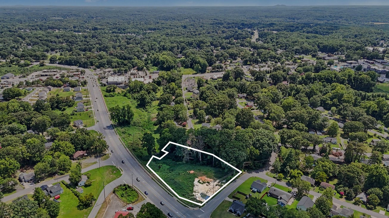 For Sale
Mixed Use / Land / Multifamily
A 1.24-acre C-3 corner site with public utilities, a new topographic survey, a building pad, and concept work for several commercial or residential paths.
 For Sale
Multifamily / Land
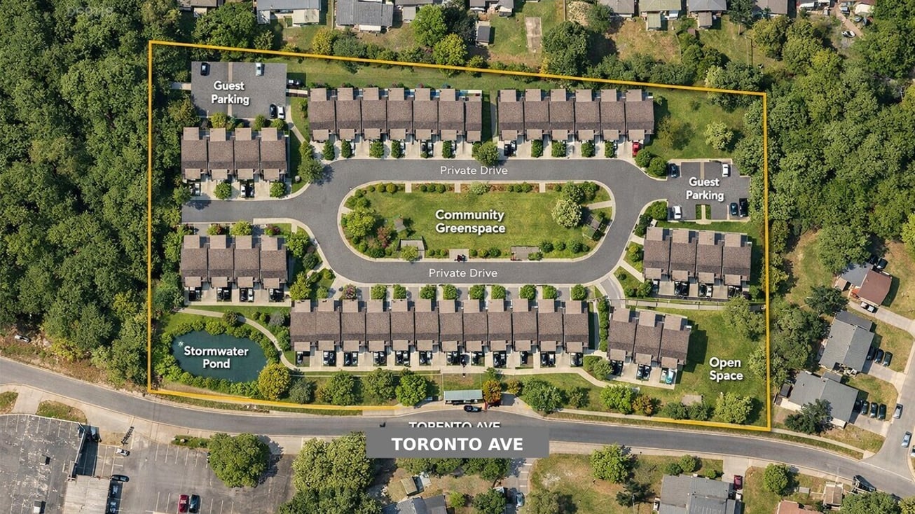
A 5.9-acre infill opportunity with RU-5 zoning, nearby utilities, and a reported path for more than 40 homes or townhomes.
 For Sale
Commercial Land
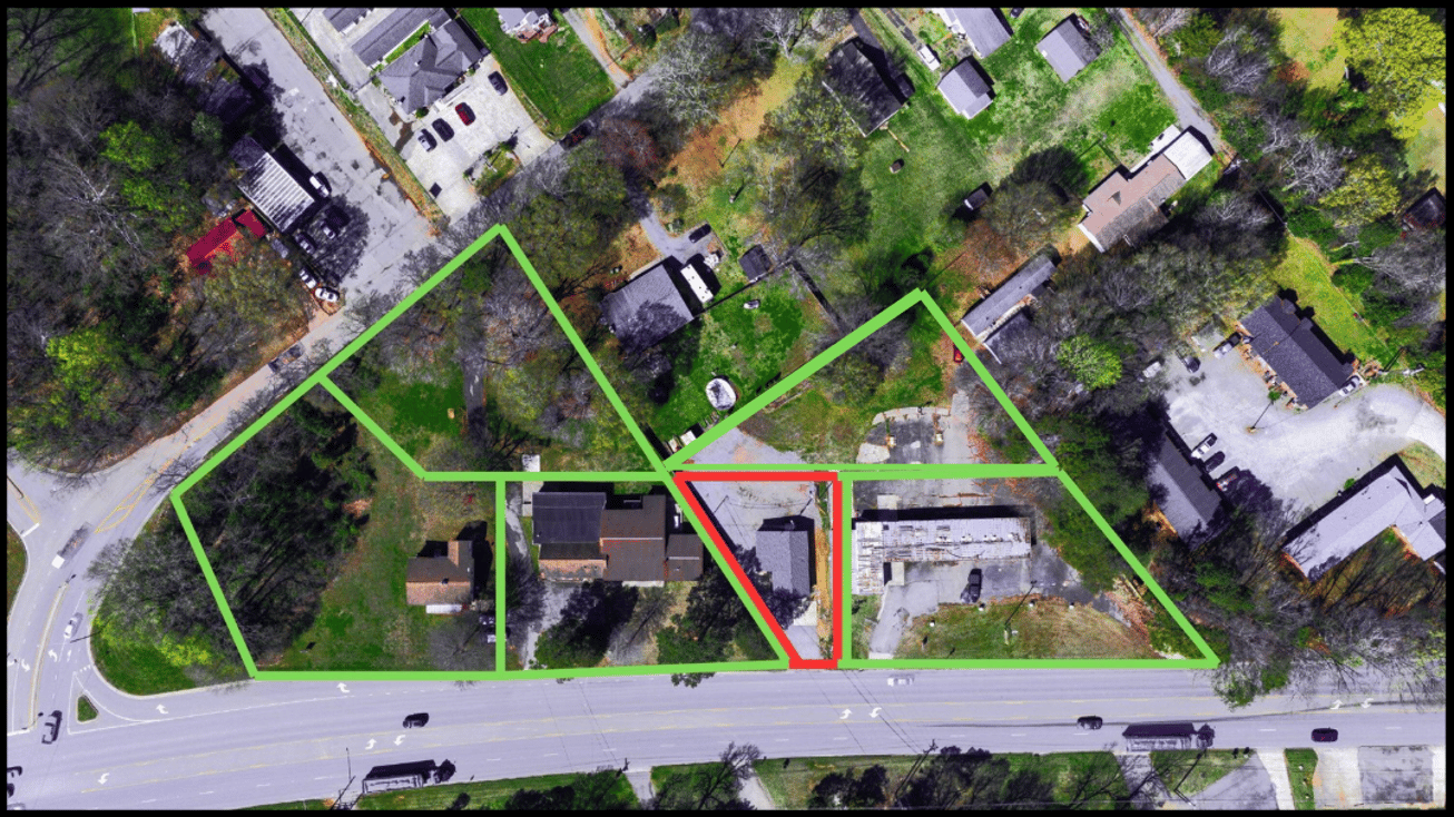
A 0.15-acre Belmont site beside CaroMont Regional Medical Center, offered as an individual parcel with the option to assemble adjacent medical-zoned properties.
 For Sale
Commercial / Industrial Land
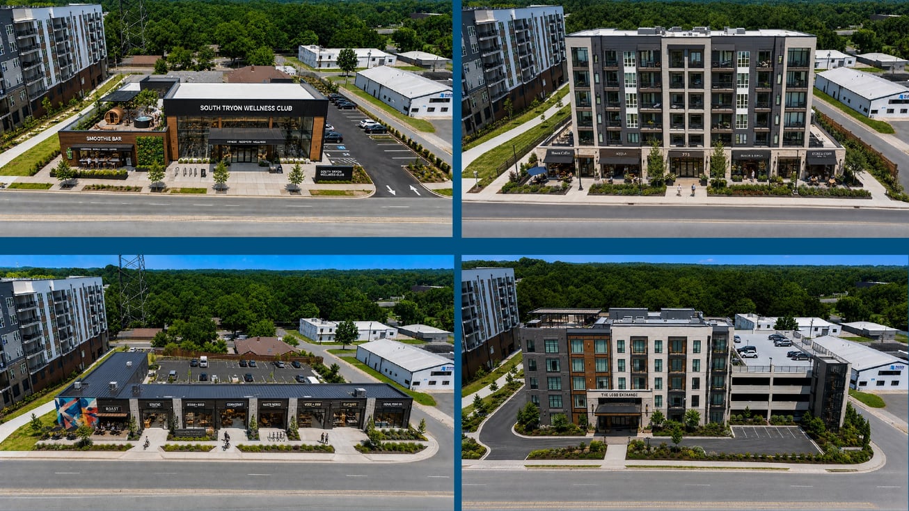
A 0.63-acre South Tryon corner with dual frontage, light-industrial zoning, and a potential rezoning path for denser urban uses.
Commercial Land decision tool
Organize zoning, policy, title, survey, access, utilities, environmental, stormwater, soils, yield, approvals, timing, and cost questions before the option period disappears.
Request a copy and tell Ola what you are evaluating. She can point you to the questions that matter first.
Request the decision toolRequested by form and delivered by follow-up. No placeholder download.

Work with Ola
A commercial property decision usually starts with incomplete information, a deadline, or numbers that do not quite reconcile.
Share the address, use, timing, and what concerns you. Ola will help define the next questions, identify the missing information, and decide whether the property deserves more work.
Questions clients bring first
Review title, survey, access, zoning, policy map, utilities, topography, soils, wetlands, floodplain, environmental history, stormwater, yield, approvals, cost, and timing.
No. The policy map guides expected development patterns. Current zoning and the applicable approval process still control what can be built unless a change is approved.
It should reflect the specific investigations and approvals needed. Utility studies, surveys, environmental work, concept plans, rezoning, and agency review can require very different timelines.
Gross acreage is the full parcel. Usable area may be smaller after rights-of-way, buffers, wetlands, floodplain, slopes, stormwater, easements, setbacks, and access requirements.
Yes. Work may include opportunity framing, diligence organization, likely-buyer analysis, pricing, marketing, offer comparison, and negotiation around contingencies and timing.
No. A concept can help frame questions, but architects, engineers, attorneys, environmental consultants, utilities, and reviewing authorities should verify feasibility.
Research notes
Market information last reviewed August 14, 2026. Figures are dated snapshots and may change. Property decisions require current verification.
Commercial Land advisory
Send Ola the address, target area, use, or investment question. Start with what is known and what still feels uncertain.
Evaluate a commercial site